 About SNG
Ok, so what is SNG?
Simply put, SNG means "Satellite News Gathering," or, using satellites to facilitate live television pictures.
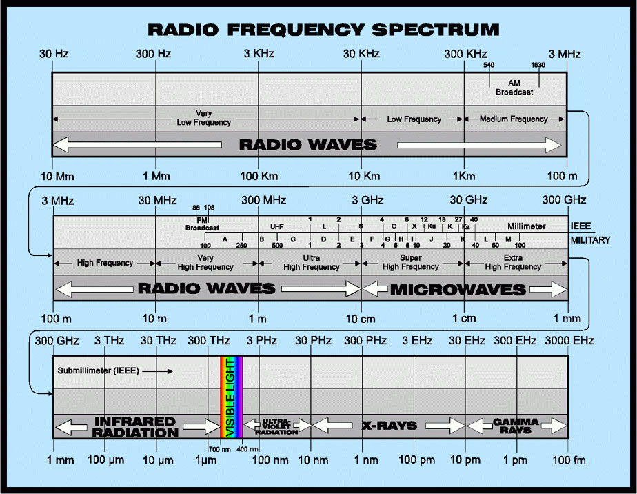
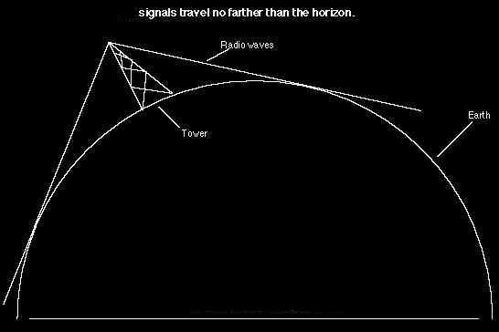
Big deal. I see live field reporters every day on the local news. How's this different?First, you have to understand a little about radio waves.
|


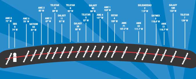 |
Thankfully, all the communications satellite stay "parked" in the same place in the sky, right above the equator. This is called a geosynchronous orbit, meaning the satellite moves at the same speed at the Earth's rotation, making it appear in the same place all the time. Other orbits include asynchronous, which includes low orbit satellites such as the space shuttle. These orbits are only a few hundred miles up. Polar orbits stay fixed in space as the Earth rotates below. The chart on the left shows the North American arc of Ku-band satellites. Uplink operators know what part of the sky they need to start searching to find a satellite. |
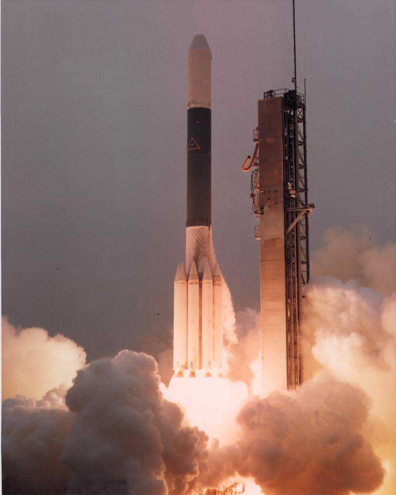 |
Satellites are pushed into orbit via rockets, often launched from areas close to the equator. The vehicle on the left is a Delta. Rockets launched from the equator need less fuel to get their payload into geosync orbit. That orbit is about 88 times higher than the space shuttle typically goes, and it requires a rocket with lots of fuel. Equatorial launches get a boost from the Earth's rotation. Since the Earth is moving through space fastest on the equator, the boost effect is greatest there. Once a satellite is in orbit, it has enough fuel to remain for around 10-12 years. Later in its life, it can't keep a steady orbit and becomes inclined. Once they get too sloppy, they can either be deorbited like MIR, or moved to a high "graveyard" orbit, which is more common among the high geosync sats. Satellites in the arc are spaced 2 degrees apart at their closest. This means that a dish movement of a few inches can mean having or not having the signal. Once one satellite is identified, it orients the operator and they can then go easily anywhere else in the arc. The most stressful part of a SNG operator's day can be quickly "finding a bird" during a breaking news story. A good operator can find the correct satellite in about 5 minutes. |
How do you identify a satellite?
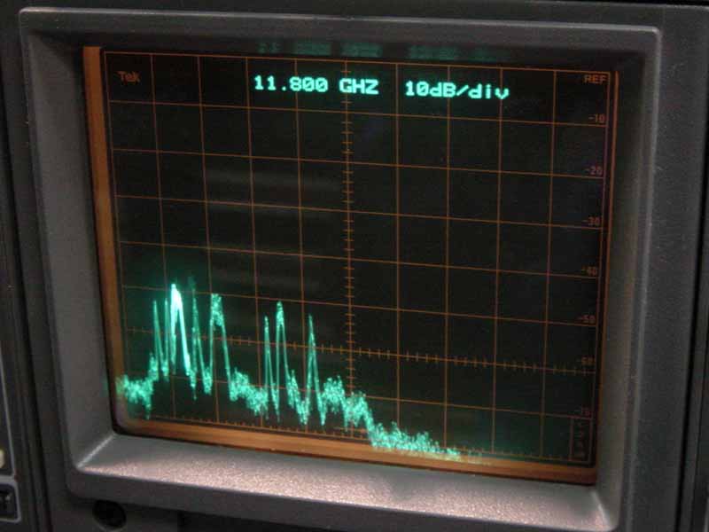
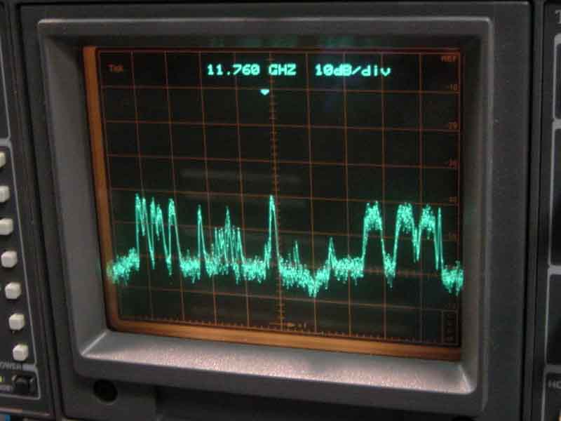
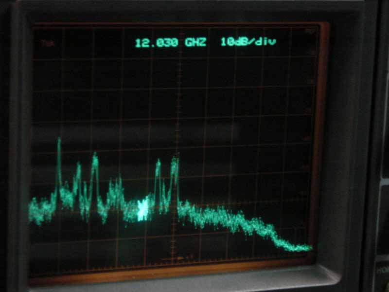
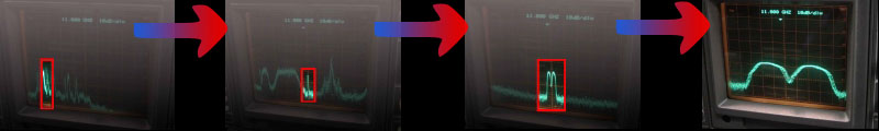
| You have to look at its nametag! Well, sort of. Each satellite has a unique pattern when its signals are viewed on a spectrum monitor, or THE SCOPE as its called by SNG ops. This little piece of equipment is at the heart of any uplink operation. Without it, it is practically impossible to find and identify satellites. As the dish tracks across the sky (looking where the sats should be) signals will suddenly appear on the scope. They don't always jump right out; often it is just a small indication meaning the dish has to be fine tuned by moving the elevation (up/down) and azimuth (east/west) slightly. |
Full 500MHz span view
SBS-6 GE-5 Telstar-4 Telstar-6
 |
 |
 |
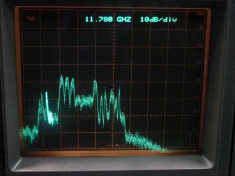 |
SBS-6 has a very identifiable pattern, once zoomed in.
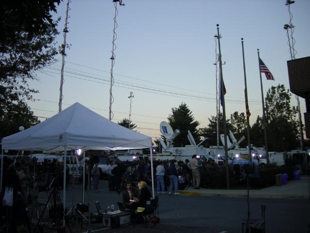
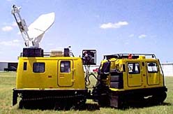
What do sat trucks look like? Where do they come from?
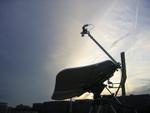
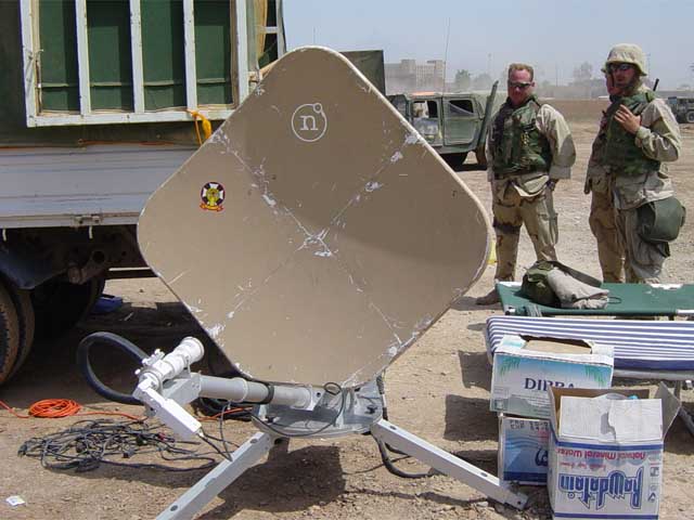
| Uplinks can be built on several platforms, including vans, trucks, and portable units. They have been built in busses, and ATV's too! They are built by several "intergrators" around the country, including Wolf Coach, Frontline, and Shook. Although they may share a common design, each one is unique. For sat trucks, they start with a bare truck frame, and build from the ground up. Building trucks requires a lot of custom fabrication, and about 6 months to complete. New trucks can cost between $500,000 and $1,000,000, depending on what's inside. |
 |
 |
 |
 |
 In this section you will find a illustrated explanation of how satellites are used for live television broadcasting. |
 Washington DC-based Diversified Communications provides a wide range of services for broadcasters, including camera and crew rentals,standup positions, teleport & fiber services, and of course, satellite trucks and flyaways ready to deploy world wide at a moment's notice. |
 The photo gallery contains pictures from hundreds of uplink adventures, from breaking news to sporting events. |